
Ruda Reservoir
| The Ruda Reservoir is located within the communes of Iłowo and Lipowiec Kościelny. First of them belongs to the district of Działdowo and Warminsko-Mazurskie Province, the second one belongs to the district of Mława and Mazovia Province. The Reservoir is a property of the treasury. It is supervised by the Province Institute for Land Reclamation and Water Facilities. |
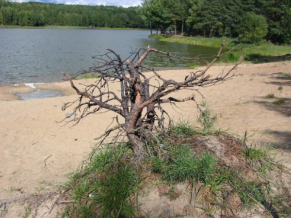
| The Reservoir is situated within Zielunsko- Rzegnowski Protected Landscape Area. It was created in 1976 as a result of damming waters of the upper Mławka River. Its construction began in 1971 thanks to Mława Land Friends Association's efforts, local authorities and many citizens of Mława. The area where the reservoir is located is a kind of a basin surrounded by tree covered hills. Because of that and the presence of gravel, sand and clay this area was perfect for creating a water reservoir. |
| The Ruda Reservoir was originally built as a storage reservoir to store water needed for irrigation of the nearby fields located below the level of the river. Nevertheless, it has never served as such. But this 36 hectare reservoir, beautifully situated in the valley of Mławka, quickly became a popular recreational place. Mława's Sport and Recreation Centre organized a bathing place with lifeguards and created there a wooden pier (which has recently been restored). There are also other facilities: a playground, water equipment rental and a beach. |
| Basic parametres of the reservoir are: - Max. length- 2150 m. - Max. width- 330 m - Shore length- 5012 m |
| The reservoir is exploited and restocked by Mława's Fishing Association and makes up, so called "special fishery". There are many kinds of fish there such as : carp, pike, tench, zander, roach, perch and crucian carp. |
| Despite not having a lot of catchment area the reservoir is used as a training place for water scouts for Parish Scouting Troop in Mława |
Hiking Trails
| In 1979 on the 550th anniversary of the foundation of Mława and the 40th anniversary of Nazi assault on Poland, on one of PTTK Board (Mława's branch) sessions the decision of marking out two thematic trails around Mława was made. The first hiking trail, which is about 40 km long, goes mainly along the defence line and is called September 1939 Warfare Hike. It is marked red. The second one is 4 km long and is called 550 Mława's Anniversary Hike and is marked green. |
| September 1939 Warefare Hike Trail |
| The starting point of this hike trail is in the very city centre by the town hall. The route goes along the streets of Mława to the village of Nowa Wieś. It turns left by the bus stop and crosses the narrow-gauge railway tracks. After you pass the village, you go across wide meadows from which picturesque tree-covered hills are visible. The route goes through the forest to the village of Sławogóra Stara, near Niemyje Swamps. The route goes along the edge of the forest where symbolic graves of soldiers who died during September 1939 fights are situated. Next the path enters the forest and goes towards the village of Windyki. On the right you can see hills (up to 184 m above the sea level of height). |
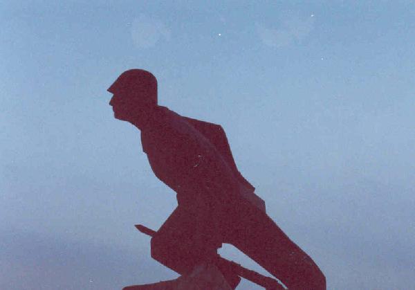
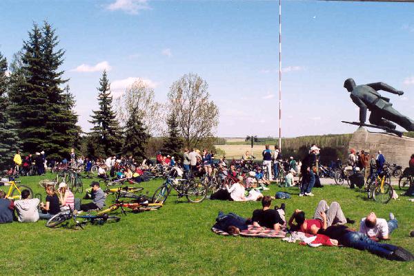
| From that moment the route goes along the Polish defence lines from 1939. Easily visible are numerous bunkers with partly preserved ditches for riflemen, a section of the defence line of I Battalion of Infantry Regiment. After a 1.5 km walk through a pine forest and getting to the forest edge, you can see two other bunkers in the field. First one of them is situated on the way to the village of Windyki and the second one on the way from Windyki to Mława. The route does not reach Windyki and after half a kilometer it turns north. Then it goes to the village of Uniszki Zawadzkie, where the Mausoleum of September Soldiers is situated next to the national road number 7. It is a monument dedicated to heroic defenders from the 20 Armoured Division of "Modlin" Army. |
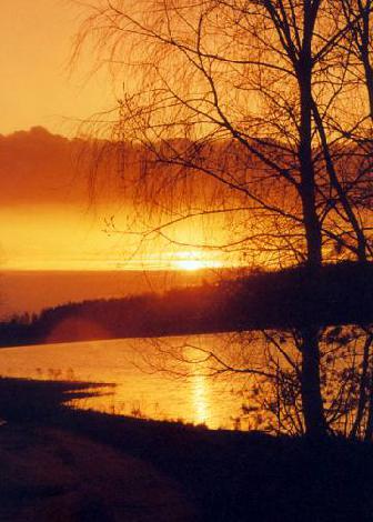
| After that the way leads over not big hills towards the village of Krajewo, where there are picturesque little lakes surrounded by lush greenery and woods. Over there in September 1939 there were defensive points of II Battalion of 80 Infantry Regiment commanded by major L. Jędrzejczak. The hike continues through the forests towards Studzieniec, where it goes south and then north- west towards the village of Zimnocha. On the way many shelters, located on the tree-covered slopes, can be seen. They were the defensive points of II Battalion of 80 Infantry Regiment. Then the route goes along a dirt road towards the village of Mławka, crossing the Mława-Działdowo railway tracks and then it is marked along the Mławka river to the Ruda Reservoir. |
| Next the path leads along the south shore of the Ruda Reservoir, crosses the sluice and goes towards the village of Dwukoły. After passing forestry management buildings, it goes toward the village of Krępa, where you can find a XIX century brick mansion surrounded by a landscape park. The mansion became popular thanks to Maria Dąbrowska and her novel "Nights and Days". Then you go from Krępa to the village of Turza Mała passing meadows and forests. Afterwards the track goes along the river of Mławka. Next bunkers to be passed have a clear trench line and they used to be the defence point of II Battalion of National Defence. From the village of Słomka all the way to Łomia the hike leads through a forest and later along an asphalt road to Mława. After reaching the route Mława- Sierpc, you should go towards the village of Wojnówka where within the distance of about half a kilometer on the grounds of former gravel works the Monument- Mausoleum is located. The monument commemorates 364 prisoners murdered here on 18 January 1945 by Nazis. |
| Going along Sierpc- Mława road you reach Mława where on Sienkiewicza St. you pass a mound dedicated to 1863 insurgents. Then, in the public park, you pass a fountain with the figure of legendary Muława and a monument of Marshal Józef Piłsudski. Next the route goes along 3 Maja St and Stary Rynek St and ends at the monument of Saint Wojciech. |
| 550 Mława Anniversary Hike Trail |
| The hike has its beginning and its end on Stary Rynek St. The route goes as follows: Stary Rynek St, Chrobrego St, Żwirki St, Wójtostwo St towards the forest and then along a dirt road and through the forest towards the village of Krajewo. When coming back you should go through the forest first back to Mława and then along Kopernika St, Lelewela St to the public park and after that along 3 Maja St to Stary Rynek St. It is a leisurely walk, mostly through a forest area. |
| Bicycle Route |
| The route of 45 km goes along asphalt roads as well as dirt roads. It begins at the railway station Mława Miasto, goes around the city centre and later along an embankment towards the flyover. Right behind it you should take the left fork and ride along the old railway embankment. Having reached the road to the village of Otocznia Stara, the route turns left and then, after about 100 metres, it leaves the asphalt road to follow a route along the embankment. After reaching the main road, you ought to turn right towards Wyszyny, where on the hill there is a church and a cemetery with graves of September 1939 soldiers. |
| From that point the hike leads to the village of Wiśniewo where it crosses the national road E-7 and later goes to Podkrajewo. Then after a junction it turns right towards Mława, going through the village of Wojnówka and near Wiśniewo it turns right to Korboniec. In Korboniec the route turns right again into a dirt road, which curves slightly and leads to the road Mława- Turza. There you turn left and cycle down for about 100 metres. Next you should take the first turning on your right and through a forest go to a red hike trail. You follow the red marked route until you get to Mława- Żuromin road, then down the road until you get to the road to Lewiczyn. On the right the first bunker is visible. During the entire hike 9 bunkers can be seen. |
| From Lewiczyn the way leads to the road to Mława and next it turns into the road leading to the reservoir. Then you should go towards Mława- Działdowo road, turn left and go down for about 100 m, climbing the railway embankment. Having crossed the tracks the route turns left and goes along a dirt road, passing the village of Zimnocha on the left. Not reaching the village of Piekiełko you should turn right and go until you get to the nearest path heading left. The route then crosses the road to Piekiełko and goes straight forward leaving on the right side the Krajewo Lake. Afterwards it continues along the verge of the national road E-7. You get then to the Mausoleum in Uniszki where the hike has its end. |