Opublikowane na: Mława (mlawa.pl)
Autor: root@npc.pl
Location
Publikowane od
Publikowane do
 [1]
[1]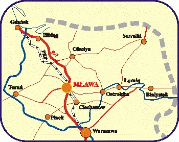 [2]
[2]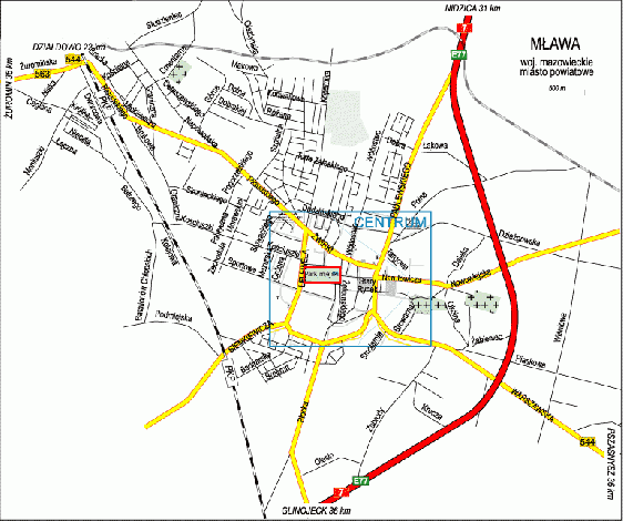 [3]
[3]
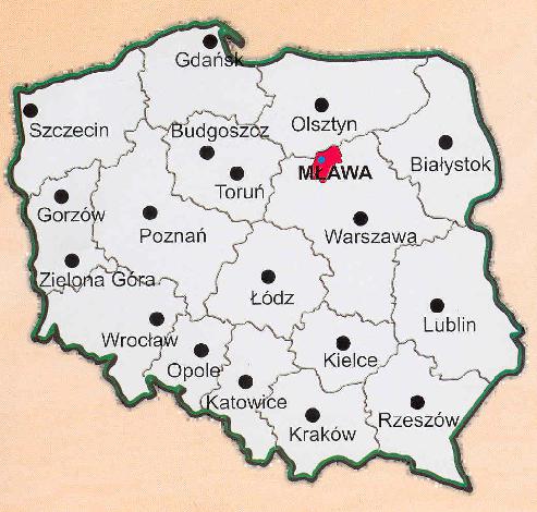
| District town located in the northern part of Mazovia Region, 120 kilometres from Warsaw. It has a population of over 30 thousand and takes up the area of 34.86 km2 As far as geographical division is concerned, Mława belongs to the macroregion of Central Polish Lowlands (to be exact: north- east part of North Mazovian Lowlands) North Mazovian Lowlands region is the northernmost part of Central Polish Lowlands, comprising, among others The Hills of Mława on which the town is located. The landscape is very diverse with numerous kames and moraines. Agricultural areas prevail here. The town has the following coordinates: longitude 20o 23' east, latitude 53o 07' north. The highest point, 180 m above sea level, is in the north- west part of the town, the lowest point, 135 m above sea level, is situated in the southern part of Mława, in the valley of the river of Seracz. The highest point is at 180 m above sea level whereas the lowest point is at 135 m above sea level. |
Road transport The following roads go through Mława: national road no 7, linking the South and the North of Poland provincial roads: - no 544 Brodnica -Działdowo -Mława-Przasnysz - no 563 Rypin - Żuromin- Mława - no 615 Mława - Ciechanów district roads : - no 351 Szreńsk - Mława - no 303 Turza - Krępa - Lewiczyn - Mława - no 312 Mława - Windyki - Wieczfnia - no 320 Mława - Dębsk - Dzierzgowo - no 352 Turza - Łomia - Mława other roads of local importance |
Roads Length of national roads- 6 km Length of provincial roads - 9,3 km Length of district roads - 26 km Length of urban roads - 70 km |
Railway transport An electrified railway route Warszawa - Gdańsk goes through Mława. It is a part of European trunk-line E-67 Gdańsk - Wiedeń, |
Air transport The nearest airports in the vicinity of Mława: - Warsaw - 135 km - Olsztyn - 90 km - Szczytno - 80 km - Przasnysz - 30 km |
Area of land in hectares (%): Farmland - 1881 ha (54%) including: arable land- 1474 ha - orchards - 18 ha - permanent meadows - 186 ha - permanent pastures - 80 ha - built-up arable land- 118 ha - ditches- 5 ha Forest grounds, tree- covered and bush-covered land- 838 ha (24%) |
Built-up and urbanized areas - 726 ha (21%) including: residential areas- 427 ha - industrial areas- 4 ha - other built-up areas- 0 4 ha - urbanized areas which are not built- up- 10 ha - recreational and leisure area- 19 - roads - 188 ha - railroads - 73 ha - others - 2 ha |
Land underwater- 5 ha including: under flowing surface waters - 5 ha - ecological grounds - 0 ha - wastelands - 32 ha - other areas - 4 ha |
Adres źródłowy: https://mlawa.pl/artykul/location